Annapurna Circuit Trek
The greatest trek in the world — a complete Himalayan circuit
Overview
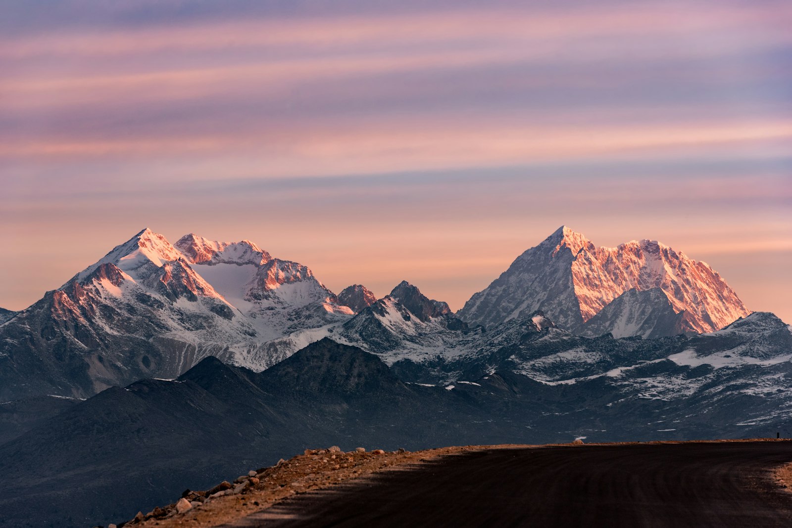
The Annapurna Circuit is widely regarded as one of the world's greatest treks — a complete loop around the Annapurna massif that packs more landscape diversity into a single journey than almost any other route on earth. Beginning in the subtropical river valleys of the Marsyangdi, the trail climbs through rhododendron forests, terraced farmland, and pine-scented ridgelines before breaking above the treeline into the raw alpine desert of the Manang Valley. The transformation is staggering: within two weeks you pass from jungle heat to arctic cold, from rice paddies to windswept yak pastures.
The undisputed crux of the circuit is Thorong La Pass at 5,416m (17,769ft). An early morning departure in the dark, headlamp beams cutting through thin air, followed by a long descent into the sacred valley of Muktinath — this is one of trekking's iconic experiences. The pass demands respect, good acclimatization, and an early start, but it rewards with panoramic views of the Himalayas that few other vantage points can match.
Crossing into the Mustang rain shadow, the landscape shifts dramatically again. The ancient walled town of Kagbeni marks the gateway to Upper Mustang, and the wind-scoured cliffs and ochre earth feel more Tibetan than Nepali. Muktinath temple, sacred to both Hindus and Buddhists, draws pilgrims from across the subcontinent and adds a profound spiritual dimension to the journey.
Throughout the circuit you move through a tapestry of ethnic communities — the Gurung and Magar farmers of the lower valleys, the Thakali innkeepers of Kagbeni and Jomsom, and the Tibetan-influenced communities of the high trans-Himalayan zone. Each culture brings distinct architecture, food, and festivals. For those with extra days, a side trip to Tilicho Lake (4,919m), one of the world's highest lakes, adds yet another layer of magnificence to an already extraordinary route. The Annapurna Circuit is not just a trek — it is a complete Himalayan education.
Day by Day Itinerary
Depart Kathmandu early by tourist bus or private jeep for the 6–7 hour drive to Besisahar (760m), the administrative gateway to the Annapurna Circuit. After lunch, take a short jeep or walk to Bhulbhule (840m) to properly begin the trek and register permits. The evening offers gentle riverside scenery and a chance to sort your pack and meet fellow trekkers.
Permits & Cost Breakdown
Required Permits
| Item | Cost | Notes |
|---|---|---|
| Annapurna Conservation Area Permit (ACAP) | $30 USD | Required for all trekkers in the Annapurna region. Purchase in Kathmandu at the Nepal Tourism Board office (Bhrikutimandap) or in Pokhara. Bring passport-size photos. |
| Trekkers' Information Management System (TIMS) | $20 USD | Mandatory for all independent and guided trekkers. Available at the same offices as ACAP. Keep both cards accessible as there are multiple checkpoints along the route. |
Additional Costs
| Item | Cost | Notes |
|---|---|---|
| Licensed Trek Guide | $35–45 USD/day | Highly recommended for safety, navigation, and cultural insight on this long high-altitude route. A guide also significantly assists in emergency situations near Thorong La. |
| Porter | $20–25 USD/day | Porters typically carry up to 25 kg. Hiring a porter not only eases your load but directly supports local livelihoods. Ensure your porter has proper gear and insurance. |
| Teahouse Accommodation | $10–25 USD/night | Basic twin-share rooms are cheapest; rooms with attached bathroom cost more. Accommodation is often subsidized if you eat your meals at the teahouse — a common and expected arrangement. |
| Meals (per day) | $25–45 USD/day | Dal bhat is the best-value, most nutritious option and is usually unlimited refill. Prices rise significantly at altitude (Manang, High Camp). Budget more for Manang and above. |
| Bus / Jeep to Besisahar | $15–20 USD | Tourist buses from Kathmandu to Besisahar depart Gongabu bus park. Shared jeeps are faster. A private jeep to Syange or Dharapani (skipping some road sections) costs $80–120. |
| Jomsom–Pokhara Flight | $80–120 USD | Tara Air and Summit Air operate this route. Book in advance during peak season. Morning flights only — book the earliest slot available. Jeep alternative costs $25–35. |
What to Pack
Tips & Important Information
Altitude Sickness Is a Real Risk — Know the Signs
Above 3,000m, watch for symptoms of Acute Mountain Sickness (AMS): persistent headache, nausea, loss of appetite, dizziness, and difficulty sleeping. Mild AMS is common and manageable with rest and fluids. Severe symptoms — confusion, inability to walk straight, or crackling lungs — are emergencies requiring immediate descent. Never ascend if you have AMS symptoms. Attend the free HRA clinic lecture in Manang and carry a pulse oximeter to monitor blood oxygen levels throughout the upper circuit.
Start Thorong La Before 4am — Wind Closes the Pass
This is the most critical logistical tip on the circuit. Afternoon winds on Thorong La can reach dangerous velocities and are extremely cold. Most accidents and turnarounds happen to trekkers who started late and are caught in deteriorating conditions near the summit. Set your alarm for 3am, eat breakfast by headlamp, and aim to summit by 9–10am. If you are still on the ascent past 11am, seriously consider turning back to High Camp.
The Jeep Road Is Manageable — Plan Your Route Smart
The road from Besisahar to roughly Chame has taken away much of the classic lower circuit. Rather than fighting it, start walking from Dharapani or Chame (reach these by jeep from Besisahar), saving 3–4 days of road walking and reserving your energy for the spectacular upper circuit. On the Jomsom side, take the morning flight or jeep to Pokhara rather than walking the lower Kali Gandaki valley, which is now almost entirely on road.
Mustang Permit Required Beyond Kagbeni
The medieval town of Kagbeni is freely accessible and unmissable. However, the road north from Kagbeni into Upper Mustang requires a restricted-area permit: $500 USD for 10 days, available only through a registered trekking agency (cannot be purchased independently). If you plan to explore the ancient cave-city of Lo Manthang in Upper Mustang, arrange this permit before leaving Kathmandu. It is a once-in-a-lifetime addition for those with budget and time.
Best Seasons Are March–May and September–November
Spring (March–May) brings clear skies, rhododendron forests in full bloom, and warm lower valleys. October–November is the most popular season: post-monsoon clarity, stable weather, and excellent high-altitude visibility. December–February is cold and can see Thorong La closed by snowfall. June–August (monsoon) brings leeches, rain, and restricted visibility in the lower sections, though the rain shadow of the upper circuit remains surprisingly dry.
Frequently Asked Questions
Recommended Gear
We earn a small commission at no extra cost to you.
Book a Local Guide via GetYourGuide
Connect with experienced, licensed local guides for a safe, enriching trek — browse availability on GetYourGuide.